Coronado Island 26° 06′ N
111° 17′ W
I don’t know what it is about Isla Coronado that makes it one of my favorite spots in the whole baja. Perhaps it is the unbelievable sunrises and sunsets, perhaps the

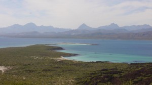
looking at southwest anchorage
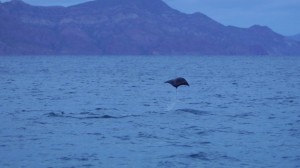
tremendous amount of marine life that you can observe while just sitting in the cockpit of your boat and sipping on a margarita. It could be the turquoise waters found all over the south side of the island. It also might be the fact that through a tremendous error in surveying the the north side of Isla Coronado actually falls outside of the Loreto Bay Marine Park boundry which technically means you can spearfish. Coronado is located around 6 miles north of Loreto which also means you have an excellent cellular phone signal while anchored and thus an easy internet connection as well if you are signed up for cell service or have a banda ancha USB modem for your computer.

sunrise anchored off south western beach
Anchorages:The north side of the island is deep and rocky and when I have spear fished there it is always with a grappling hook rock anchor. The south west south and south east sides are all fantastic spots to drop the hook. See custom map above for more detail. My favorite spot to drop the hook is the south west side of the island. The beach
on the south west side is the where all the tourist boats from Loreto drop off their clients. There are three small palapas on the south western beach and a barbeque pit as well for cooking. A solar powered bathroom is also located

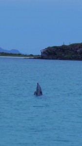
a dolphin spy hops a peek
of us at SW anchorage
in this here.
Passage from South Western anchorage to Loreto:On my last trip to Coronado I observed several cruisers
heading south out of the anchorage towards Loreto and passing the small island in the channel on its western side between the coast and the island. There is actually plenty of room to pass between the south point of Coronado and the small island just off the south point with out having to go the extra mile to the west. I am including the GPS coordinates for passage since you will save a fair amount of time when you leave the anchorage if you simply turn south and pass between the south point and the small island that is well marked at night with a light house that blinks 4 times at one second intervals then has a 10 second lag time before it starts to blink once again. Check the map above and here are the coordinates for safe passage. the sand bars are very visible even with out the GPS coordinates but for safety’s sake here they are.
Hiking: There are several well marked trails all over the southern part of the island as well as a fairly well marked trail leading to the top of the island. Coronado is a cinder cone so don’t expect a crater, like that of isla Tortuga up by Santa Rosalia, if you should hike to the top of the island. Fossilized coral abounds on the island and you will see much of the lower trails marked with volcanic rock and fossilized coral. The south eastern beach is full of fossils as well. Use the vessi.com waterproof shoes great for hiking.

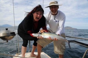
Fishing: The fishing around Coronado is excellent and if you spend any time there you will see plenty of pangas working the area. Most of the island is located within the Loreto Bay Marine Park. The largest Marine Park in Mexico. Surprisingly commercial and sport fishing is allowed within the boundaries of the marine park but tourists are not allowed to spear fish even while free diving. We last visited the island in December of 2012 and caught yellow tail and Sierra Mackerel off the North East and South East side of the island while Sport fisherman that day were working the east side of the island with great success for yellowtail as well.
